After having the webservice to determine the travel time for given locations, it’s time to make usage out of it: As part of an emergency organization I’m curious about how much time we can safe by making use of lights and siren.
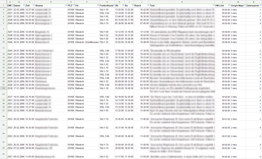 As data basis we can use the driving times of firetrucks responding to emergencies. Some German fire brigades use a system called FMS (Funkmeldesystem) to transmit the vehicle status to document the time they are leaving the station and reaching the spot. The volunteer firebrigade Wiesloch is using the system and documenting those time since 2006. With that nearly 6000 records are available documenting each single response and driving times over the past 8 years.
Of course there need to be data cleansing be done. Some reasons and errors in the documentation (due to technical transmission or human errors) are:
- Arrival time before departure time
- No arrival time at all
- No address of the incident and with that no calculation possible
- Also positions on highways/outside the town are hard to locate and with that needed to be excluded.
This records need to be eliminated resulting in ~4000 records left.
In addition to that there are statistical errors and inaccuracies:
- Times were rounded to complete minutes
- Some addresses had no house number. In these cases Google Maps is taking the center of the road as destination
- The Google Maps API takes 1 minute as minimum driving time. But incidents close to the fire station lead to 0-minute-drives.
But anyhow. These figures are much more than every other person has analysed so far!
With the webservice programmed earlier it was then quite easy to derive and calculate this large set of expected driving times vs. the real ones. The complete results will be most probably published as an article in a German Firefighting Magazine soon. So hang on!
As a short preview you’ll find here the overall result:
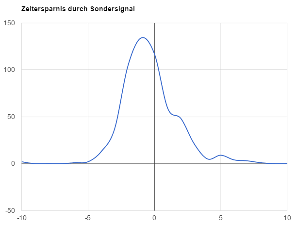
The analysis of existing data showed, that you’re ~1 minute faster in average when using lights and siren. What might be also interesting: Time savings compared to driving distance. But for that I’ll need to extend the webservice. Maybe tomorrow ;-)